
Description
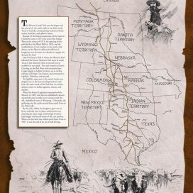
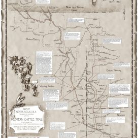
The first in a four-map series showing the early Shawnee Trail(1846-1875) from Texas to Missouri, Kansas, and Nebraska. This map depicts the different branches of the Shawnee before and after the Civil War including the East Shawnee to Missouri and Kansas, the Middle Shawnee through Kansas and into Nebraska, and the West Shawnee to Junction City, Kansas and into Nebraska.
By Gary and Margaret Kraisinger
Published in 2010
Printed by Mennonite Press, Inc., Newton, Kansas
Illustrations by the late Robby McMurtry